

Rail Maps
Find and navigate rail assets with up to date locations. Currently FREE for both iPhone and Android mobile devices.

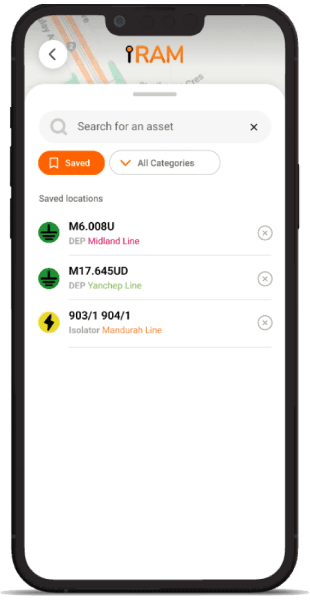
Finding rail assets just got easier
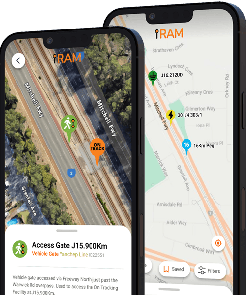
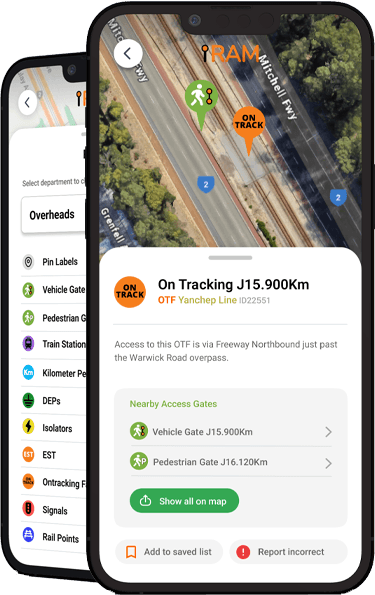
iRam Maps helps rail employees quickly locate key assets across the Perth rail network. Search our database and discover the nearest access gates to get you there, fast.
Smarter search
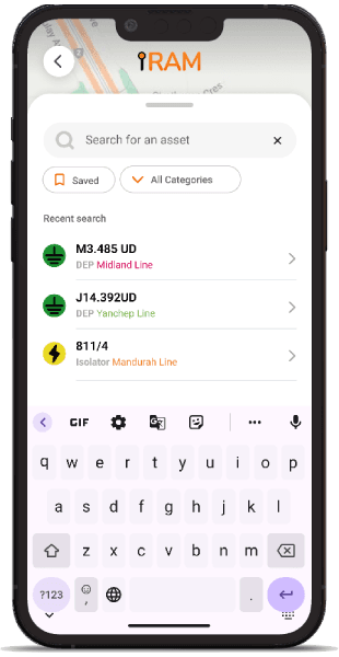
Start typing any part of an asset name and see instant results based on your keywords. It’s fast, intuitive, and built for field use.
Custom filters
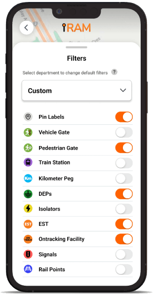
Filter the map by asset types—everything’s neatly organised into useful categories so you can find exactly what you’re looking for.
Save favourites
Bookmark the assets you visit most often. Save them to a personal list for quick access and easy navigation later on.
Frequently Asked Questions
What is iRam Maps?
iRam Maps is a map based mobile dashboard that uses accurate geolocation information of important rail assets sourced directly from publicly available information of the Perth rail network to display them as pins on a Google Map layer, with the ability to search and navigate to these locations via the nearest convenient access gate available.
Does the app cost anything?
No, iRam Maps is completely free to download and use. There is no future plan to monetize access and it has previously not charged for access. The app developer has/will not generate any income from this project.
How do I sign up?
After you've downloaded the app from the app store via links on this page, the app will guide you through a quick registration procedure. To keep the app safe from users outside of the industry, all new users must input a valid RIW (Rail Industry Worker) number, and installation is restricted to users inside Australia. Users who do not meet these requirements will have their access removed.
Whats the difference between iRam Maps and the official printed manuals?
iRam Maps uses the same asset location information, but displays them directly on top of Google Maps so you can get a clear sense of its location and nearest access. You can also search for assets, create bookmarks, and view navigation routes from your location. Assets that are not publicly available may be locked behind special permissions.
Is iRam Maps up to date?
We strive to keep iRam Maps as update as possible, adding new locations every week via updates from official sources, plus first-hand reports from trusted sources in the field. Users are encouraged to report any new or inaccurate locations.
Who can use this app?
The information displayed in iRam Maps is sourced from publicly available records, however it's catered for railway workers and professionals who access the rail reserve for any reason and thus the requirement to hold a valid RIW number to create an account.